Dunedin to Dragon Point
On September 18, 2008, the Theodore Robert finally got underway for her first major voyage. I had finally semi-retired (retired with no money) and was heading to Richmond Virginia to join my wife. On board are Rob Leyden, (First Mate), Pat Leyden (Crew), and myself, Ethan Romans (Skipper).
We left Dunedin at 1730 hours, and headed to Clearwater Beach Marina for fuel. After fueling with 100 gallons of deisel, we went into the gulf via Clearwater Pass and headed south. Although it was late, we were trying for Longboat Key where there is a nice protected anchorage just south of Longboat Pass. It was a beautiful clear night with a moderate easterly wind and calm seas. We sailed south on a course to take us to marker twelve of Egmont channel, intending to take the channel to the intracoastal then work our way south to the Longboat Key anchorage.
On approaching Egmont channel into Tampa Bay there was a significant amount of ship traffic and I decided, after consulting with Rob, that it would be prudent to avoid the ship traffic by continuuing south to the Southwest passage into Tampa Bay. This was a little longer distance when approaching from the North, but it is a well marked passage with a minimum of 16 feet of depth. Plenty for us, and most yachts, but no ship traffic.We dropped sail as we approached the intracoastal where it left Tampa Bay heading south. As we started to enter the channel we had a little excitement due to a barge entering Tampa Bay from the south through the narrow channel, but we circled around in Tampa Bay then, under power we headed south down the intracoastal waterway.
As everyone who has travelled the intracoastal at night knows, it can be a little tricky. Typically, you can travel from lighted mark to lighted mark safely as long as you avoid hitting the unlighted marks. This works well as long as all the lights are working. After we passed through the Anna Maria Island bridge, the green flasher, marker number 51, was not working. This light marks where the channel makes a significant turn to port and allows you to head directly for for the Cortez bridge. We slowed to about 2 knots, and groped our way using the GPS until we were able to spot the unlit marks that marked the turn. We could have accomplished the same using a compass heading, but, it was a bit nerve wracking at 0230 in the morning. We finally dropped anchor just south of Longboat pass about 0330 for a well deserved beer and some rest.
On the morning of the 19th, we got underway at 1010 and decided to motor down the intracoastal due to light and variable winds. The only item of note going south to Boca Grand was meeting up with the trawler Maude which was also heading south. The skipper of Maude was planning on taking the Okeechobee waterway across the state after spending the night at anchor near Boca Grand. Meeting Maude was fortuitous for us because we travelled in company and were able to go the timed bridges together on the way south. Near Boca Grand, we anchored just north of the Boca Grand marina, about a mile from the inlet. After we anchored I dinghied into the marina to pick up my cousin, Alan Meltzer who was joining us for the next few days. It was quite a dinghy ride. I have an 8 ft inflatable with a trolling motor, and the wind had picked up from the east, blowing across Charlotte Harbor and building up about a 2 ft chop. That little inflatable did the job, but there were times I wondered if we would make it back to the Theodore Robert before the batterhy gave out. Last time I tried rowing an inflatable against the wind, going even a few yards is difficult. Luckily the battery held up and I didn’t have to try.
. The next morning, Sept.27,2008, I took my cousin ashore to return the rental car, ( the rental car agency was closed the night before) and when we returned to the Theodore Robert we got underway with Key West the destination. At 1220 we headed south from marker 3 of the Boca Grand channel and set a course directly for Key West. My cousin Alan is a real shutter bug, and is actually pretty darn good at it, so he took the first pictures of our journey on this leg. We ran for 29 hours straight, with Rob and Pat taking the 8-2 watches and Alan and I taking the 2-8. This as the first time the Theodore Robert had been out of sight of land, and the vessel and crew handled it well. It was an uneventful but beautiful trip, and we tied up at the Key West Bight marina at 1730 on Sept. 28,2008.
Key West is an experience all its own. The very first night, it rained so hard that the water on Front street backed up to the point where we saw two people kayaking down the road. Alan and I had gone for a little exploring while Pat and Rob stayed at the boat, and all of a sudden the skies opened up. Alan and I worked our way back to the boat through the rain, wading in water up to our knees. We stopped at a little bar on Front Street and watched cars plow through water up to their headlights while the crowd at the bar cheered or booed based on the wake the car was making. Meanwhile, Pat and Rob were stuck trying to shut up the boat and contending with clogged scuppers.
We spent two nights and a day in Key West resting and touristing while making minor repairs and upgrades to the boat (we cleared the scuppers, amongst other things). In the morning after our first night in Key West we strung up our awning and the relief from the sun was tremendous. After our first full day, as evening approached storm clouds gathered in the East and headed our way. While we were watching, a huge funnel cloud formed and we watched it move closer then out over the water and over several boats that were anchored. (See the awesome pictures Alan took) Things settled down and we thought that we were good for the night, but then another squall came through and blew down our awning. Aarrgghh, but at least the scuppers drained properly.
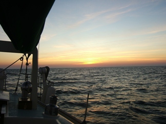
My cousin Alan had intended to cruise with us until West Palm Beach; but he had to be in West Palm Beach on Thursday morning for business reasons. Due to the extra time spent at Key West, we would not make West Palm in time so we decided that we would stop at Marathon, where he would rent a car and return to West Palm Beach. We departed Key West at 1150 on Tuesday Sept. 30, heading for Marathon on the outside. We were planning on going to the Boot Key anchorage where we could drop off Alan and comfortably spend the night without spending a lot of money. The passage was smooth and after stopping to snorkel at Looe Key, we witnessed the most spectacular sunset I have seen in years. (See Alan’s photos). We arrived at the Boot Key channel about 2130, and attempted the Boot Key bridge. There was no response, then I remembered, from a trip many years ago, that they close the Boot Key bridge at 1900. We turned around in the narrow channel and docked at Burdines Marina, which is seaward of the Boot Key Bridge.
The next morning Alan collected his gear and caught a cab to the airport for his rental car and at 0830 we got underway for a non-stop trip to West Palm Beach. I decided to head off shore about 18 miles to try to catch some help from the Gulf Stream. We were motorsailing along at about 6 knots and were trolling just in case, and as we entered the Gulf Stream at dusk, the reel starting singing. The autopilot was on and Pat and I were on deck, so I ran back to the reel, and started tightening the drag. I am not much at fish stories but after a 20 minute fight I brought the fish alongside and Rob, who had been napping came on deck and expertly gaffed the fish and brought it aboard. (See photos). When I first got the fish alongside, Rob thought it was a barracuda, then on closer inspection, I knew that it wasn’t a barracuda, but thought it might be a King Mackerel. (shows you how much we know about deep sea fishing). I kept thinking it was a King, until we got to West Palm, when my cousin asked where we caught the fish (before he saw the photos) and I told him that it was off Key Largo in 600 feet of water. He said that I couldn’t be right. Kings don’t hang out in 600 feet of water! I may not be a fisherman, but I am a pretty good sailor and navigator, and I was sure of our position. He surmised that it might be a Wahoo, and sure enough, when we looked at the photos, it was a 55” Wahoo. We have been eating that fish now for some days!
After the fish catching, we continued through the night, staying just north of a line of thunderstorms. We motorsailed, and, with the help of the Gulf Stream, averaged between seven and eight knots through the night. We came through the Lake Worth inlet about 1500 on Oct. 1, 2008 and tied up at the Lake Park marina at 1530.
We stayed at Lake Park Marina for three nights and were royally entertained by my family, Sister Nina, her husband Mike, Uncle Artie and Aunt Rita, and cousin Alan.
The Lake Park Marina was a find. Great facilities, courteous and helpful staff, and lots of places close by to re-supply.
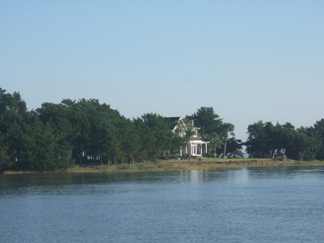
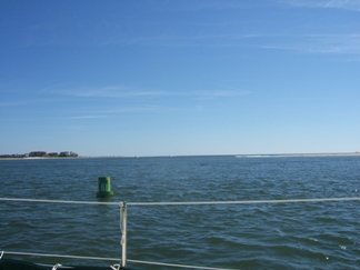
Due to the weather we decided to stay in the intracoastal from West Palm to Melbourne, where we had scheduled a stop with my friend Malcolm Baird and his wife Barbara. We got underway from West Palm at 1000 on 5 Oct. and motored up the intracoastal to an anchorage just south of Fort Pierce. The next morning we stopped in at the Fort Pierce Municipal Marina, pumped out the honey tank and re-fueled with 80 gal of diesel. We continued North motorsailing and arrived at Dragon Point (the southern tip of Merritt Island) at about 1800. We headed up the Banana River to the Grand Canal where my friend Malcolm lives and tied up at his dock at 1900.
For those who know the area, they will be disappointed to know that the dragon at Dragon Point has collapsed into the water. The house that is on the point is in great disrepair and is for sale. Sad!
On the way from West Palm to Melbourne, Rob developed a toothache and an infection so we have extended our stay in Melbourne to get him treated. He is now on antibiotics, and we intend to head out tomorrow morning, Oct 8, heading for New Smyrna Beach to visit with my mother there, then we will be off North to the Chesapeake, with no particular stops in mind.
From Dunedin to Melbourne, we used about 80 gallons of fuel, due to adverse winds. We fueled up in Fort Pierce, and departed with about 120 gallons of diesel on board, which we hope will get us to the Chesapeake. We have been trying to maintain 5 knots, and with the winds we have had we have been motoring or motorsailing most of the way. I hope that conditions will be more favorable for sailing for the rest of the trip.
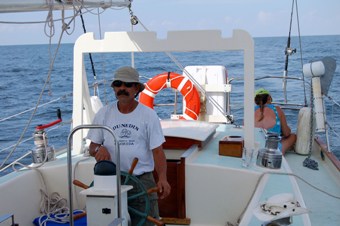
Ethan at the helm, Boca Grand to Key West
Rob at the helm, Boca Grand to Key West
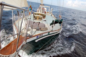
Full sail, Boca Grand to Key West
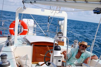
Bob underway, Boca Grand to Key West
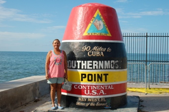
Pat in Key West
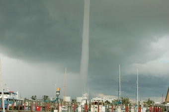
Waterspout heading our way, Key West
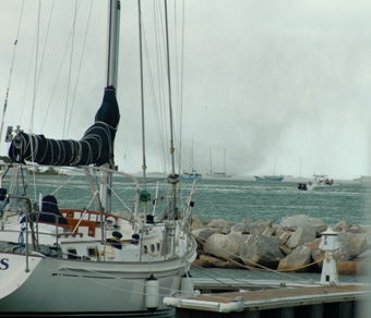
Water spout about 1 mile off, Key West
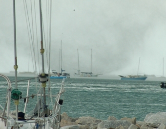
Same as above, little better look
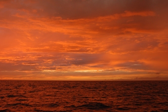
Sunset off Marathon
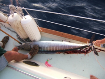
55 inch Wahoo off Key Largo
Dragon Pt to Fort George Island Fl.
October 12,2008
We left Melbourne as planned and arrived in New Smyrna Beach late on the ninth of October. We were pummelled by severe Thunderstorms just south of New Smyrna and had to anchor for about two hours due to lightning and poor visibility, to say nothing about crew exhaustion and misery. We stayed in NSB at the municipal marina for two nights before setting out again. (My mother lives in NSB and it was her birthday). In NSB during our stay, there was a major fishing tournament. These fisherman had fifty foot sport fishers with tuna towers almost as high as my mast (59 feet off the water). It was interesting that our immediate neighbors were some of the rudest people that I have ever met while on the water.
We left NSB on the 11th of October hoping to make St. Augustine that day. We were totally out of sync with the tidal currents and fought them the whole way. Our speed made good over the bottom was between 4 and 4.5 knots. We fought our way at night past the Matanzas inlet, and I have seen few channels in the intracoastal which are harder to navigate at night. We found ourselves outside the channel several times, but luckily did not run aground. We ended up anchoring just outside the channel near Crescent Beach Florida. Turn in time was after midnight, which precluded a crack of dawn departure. we did get underway on the 12th at 0900, which wasn't bad considering the late time of securing the boat at anchor on the 11th. We were still out of synch with the tidal currents, but when we passed the midpoint between St Augustine we actually had the curren with us almost to Jacksonville. After passing the St Johns river, we had an incoming tide and the current pushed us ahead and our Speed Over Ground was up to 7 knots. What a difference. This day we decided that it made sense to anchor during daylight and try to get some extra rest and a hot meal. We anchored in the Fort George Channel, about 8 miles north of the Saint Johns river. It was a bit of a tight anchorage, though deep. We had to set the main anchor twice, then put out a second anchor to handle the tidal current change we expected during the night. At this point is was about 1700 hours and for the first time, after an underway day, we actually had time to cook a meal and try to relax. The view from our anchorage is spectacular. We are loking out over salt marsh grasses with a view of the old plantaion (now a park) that is on Fort George Island. The tidal current rushes through here, but with two anchors well set I will get a good nights sleep.
Ft George Island to Charleston SC
On the morning of the 13th we left the anchorage at Ft. George and headed north once again. This leg of the trip took us through some of the most unspoiled waterways of Florida. Marsh grass everywhere, little islets along with Little Talbot and Big Talbot islands. We crossed Nassau sound and tucked in behind Amelia Island up to Fernandina Beach. We stopped for about four hours in Fernandina Beach while we had someone else cook us a meal and we resupplied at the grocery. We continued for the evening across the St. Marys river and anchored up behind Cumberland Island.
The next morning we woke to find ourselves broadside to the current! The second anchor had hung up between the rudder and the rudder foot. After a lot of thinking and judicious easing of the anchor lines, we finally were able to free the line without having to dive it. This cost us about an hour of fiddling around, but we did get it free and finally were underway again. We headed south out of the anchorage to re-enter the intra-coastal and after the turn to head north again, we were faced with several large tugs out of Kings
Bay, the submarine base. We looked behind us and saw the submarine that the tugs had come to escort. I attempted to call the tugs on channel 16 to get instructions on whether I needed to leave the channel, or what, but got no answer. I hugged the starboard side of the channel, and when the security launch ran up to us, I told him we were just heading north and trying to stay out of the way, and that we had no idea a sub was coming into Kings Bay. He told me that they don’t exactly advertise it, and it would be O.K. to stay in the channel, just DO NOT turn towards the sub. This was fine with me. We got a few pictures, and later on one of the tug pilots warned us about a local shoal, and reiterated that it was fine to stay in the channel. We did so, but I was really relieved when the intra-coastal channel diverged from the Kings Bay channel. We continued north on the intra-coastal heading past Brunswick toward Savannah. We stopped and anchored slightly up the South River, about 15 miles north of Brunswick. On the next day we hoped to make Savannah, but at about 1705, we came to the Skidaway Bridge that only opened on the hour. We backtracked about a mile to a little channel off the intra-coastal, (Wolf Island) and anchored quite securely in deep water for the evening.
The trip through Georgia, was a trip through miles and miles of unspoiled salt marsh, with a sprinkling of small islands. Some of the islands were big enough for houses and some had houses built on them. I could see no land bridges to the islands and surmise that the building materials must have been barged out to the islands. It was a beautiful trip through muddy little estuaries and it was nice to have left the McMansions behind.
On the 15th we ran the last 15 Nm to Savannah and headed out the inlet for an offshore run to Charleston. The wind had finally changed and was no longer blowing like stink out of the Northeast. This was the first break in the NE wind since leaving West Palm Beach. The wind was SW and directly behind us as we left Savannah. It was too light to hoist sail. In fact, it was blowing about 5 Kn from directly behind us so that the apparent wind was almost zero. It was a pleasant change, though we still were motoring, and we reached the Charleston channel at about 0100 on the morning of the 16th. The tide was running out at about four knots, and we were in that channel for about three hours as we tried to stay out of the ship traffic. We crossed paths with about four ships as we held station in the channel, moving pretty much sideways with about 1 knot over the ground. I finally decided to throttle up and we doubled our speed over the ground while increasing our through the water speed by about 1 knot. We finally made it up the
Ashley River opposite the Charleston City Marina, where we anchored in a designated anchorage. Our plan had been to stay a day in Charleston and re-supply, spending one night in the marina, and then heading out the next morning. The weather decided differently as a front came through and it was wet, windy and cold. We were given a spot at the “Megadock”, yep, that is what they call it. We were the pigmy amongst the giants. They had put us at the end of the “Megadock, and it was literally ¼ Nm from the bloat to the head! We got a lot of exercise. After tying up and getting a restaurant meal, Rob and Pat went into downtown Charleston to have a little fun, while I used the time to relax on the boat.
The weather report showed that there was a front coming through and that the weather would be cold and wet. We decided that the better part of valor was to stay in Charleston another day and re-supply the boat while we waited out the weather. We did just that, and the next day, Oct. 19, headed north once again.
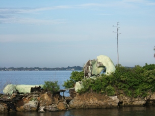
Dragon Pt. with collapsed dragon
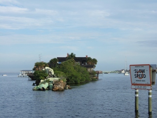
More Dragon Point
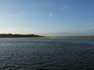
Unspoiled Florida at Fort George Island
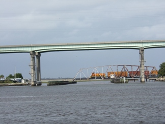
Waiting for train to cross the ICW south of Fernandina
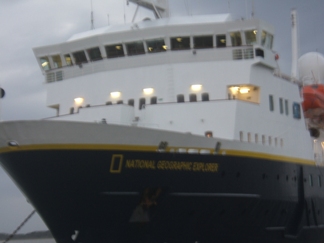
National Geopgraphic's " Explorer" St Mary's Inlet
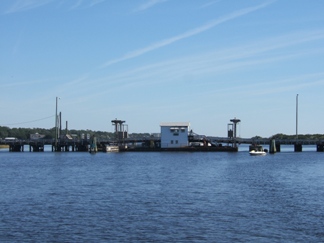
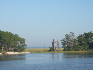 Isolated Island in Ga ICW. What is this structure?
Another Isolated island off GA ICW.
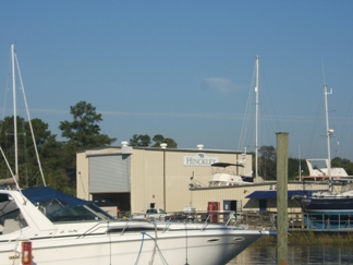
Hinckley Boat Works Just south of Savannah
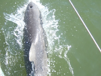
Dolphin playing in bow wake, Savanna Inlet
Sunset off Savannah
Charleston to Oriental NC
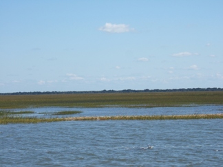
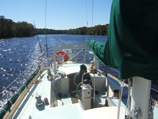
On the morning of the 19th the temperature had dropped into the 40s, and that contributed to our late start at about 1100. Late starts were becoming the norm but we made it to the South Santee River where we found it to be an excellent anchorage. It is interesting to note that on leaving Charleston, the trickle of boats going south on the ICW grew to a flood. I was told that the Annapolis Boat Show was the signal for all of the boats to head south. I wonder about that, but the trickle did become a flood. On the 20th we did get an early start, 0745, and made about 70 miles to the Cricket Cove Marina in Myrtle Beach. It is a nice quiet marina with all the amenities, and cost less than most of the marinas at which we have stayed. Here at Cricket Cove is where it really started to get cold, at least from our Floridian point of view. I bought a small used electric space heater from a fellow boater in Cricket Cove, but it could only be used when in port, or when the generator was running, which limited its usefulness. Traveling through South Carolina on the ICW is a lot like traveling through Georgia on the ICW; however there are a couple of notable spots. The Waccamaw River, north of Georgetown, becomes brackish and almost fresh water. The flora and fauna changes to fresh water flora and fauna, with cypress trees, lily pads, lots of turtles and alligators. Quite a pleasant change, but you have to look out for snags. There is a spot on the ICW south of a place called Nixon’s Crossing that the charts warn you about due to rocky ledges. Believe me, take it seriously. Grounding in this stretch will not be gentle.
On leaving Cricket Cove on the 21st of October, we proceeded north yet again. (I keep saying that because there was, in the back of my mind, the possibility of turning around and running south.) We shortly crossed into North Carolina where it seems like the only bridges are swing bridges and they are all on timed openings during the day. There were also fixed bridges, but as far as I can remember, with one or two exceptions, all of the opening bridges were swing bridges. South of Beaufort NC there are a lot of these bridges. I still do not understand the rationale for the opening restrictions. There was very little traffic on a lot of these bridges, but they still only opened once an hour. We would wait around, either motoring in circles or anchored, and watch as the trickle of automobile traffic crossed the bridges. If you have ever been upset at the bridges in south Florida, this will cure you. There is a unique pontoon bridge at a place called sunset beach. It is a one lane bridge and the cars go through one direction, then the cars go through from the other direction. The bridge is operated by a cable which pulls the bridge parallel to the ICW on the West side. If the water is really low they will not open due to the fact that the cable operating the bridge is slacked to lie on the bottom to let boats pass. Weird. This day we made it to the Cape Fear River near Wilmington and anchored about 100 yards off the lower midnight channel where we were reasonably protected and had about ten feet of water.
During the night I awoke to the wind change to the NW at about 20 knots. Checked the anchors for fouling and dragging, and with no evidence of either, I went back to sleep and slept through the rest of the night. On the morning of the 22nd, we awoke to a clear cold day, with the wind back in the NE, so we raised the anchors and headed across the Cape Fear River to continue our journey under power. We kept hoping for some change in the wind direction to allow us to travel under sail, and potentially go offshore; but except for the stretch from Savannah to Charleston, the wind was persistently strong (greater than 15 Knots) from the NE. The exceptions were when the wind would clock, from NE-E-SE-S- SW-W-NW-N-NE. In Florida I had been used to this process taking days, but from the time we left Charleston, this process would take just a few hours, with the wind back in the NE so quickly that it made no sense to try to take advantage of the short spells of semi-favorable winds. This night we found an anchorage in Mile Hammock Bay, just north of the New River Inlet. There are a lot of restricted areas around New River due to military exercises and military firing ranges. A lot of deep water bays all restricted. Mile Hammock Bay is a dredged out cove that seems to be carved out of a military base. Although not restricted, this bay seems to be a military training area. We had the military doing inflatable boat training and helicopter exercises until midnight. I definitely got the feeling that the military did not approve of our being there. There was comfort in numbers though, there were about 10 boats anchored in the bay, and we were not actually confronted by the military. Having been in the military, and knowing some of the mind set, I am convinced that it is a non restricted area, but that some colonel viewed that as his personal fiefdom and had his men do exercises in the area just to harass those of us who had dared trespass. The bottom was deep soft silt and this is the first time my 44 pound Delta anchor did not hold. Luckily we found this out as we were trying to set the anchor, so we deployed the trusty Danforth and were able to set this anchor quite satisfactorily. This was the only time we set a single anchor during the whole trip, but with no current and little wind, I felt quite comfortable with this.
During the travel through North Carolina, I noticed that Pat and Rob were getting a little antsy. We had already been traveling for thirty days and they had planned on being back in Dunedin within thirty days. In addition, Rob’s tooth was acting up again and he was running out of his medication. The three of us had discussed the two of them returning to Dunedin from somewhere in North Carolina, and since my wife Julia intended to join us in Oriental N.C. that seemed like a logical place for them to make connections to return to Fl. Rob and Pat both made it clear that if I needed them, that they would stick it out to Richmond. I assured them that since we were motoring the ICW, that, although I would miss their company and help, that I was confident that with Julia’s help I could make it the last 200 miles from Oriental to Richmond. They agreed that they would think about the choices and let me know when we reached Oriental. They made their decision on the way to Oriental, all of us agreeing that it probably was best for them to return to Dunedin to take care of their affairs.
We got underway early from Mile Hammock bay and headed toward Oriental, hoping to make it in a days run. We made good time, pushing it a little at 1500 RPM and we had the current with us most of the way. It was an easy motor until we got to the Neuse River. Our old nemesis, the NE wind, had shifted more to the east but was still blowing at about 20 knots. Crossing the Neuse River, we had a four to five foot chop. It was on our starboard bow so the boat handled it nicely, but the short steep waves made for a pretty bumpy ride with lots of spray. With the wind blowing and the temperature in the low 60s, we were pretty well chilled in spite of our foul weather gear. We tied up in Oriental at the Oriental Harbor Marina and Inn and waited for my wife Julia. She arrived about 30 minutes after we tied up, and since Pat had used the day wisely and had packed up their gear, we were able to make the gear exchange promptly, and I saw Rob and Pat off with regret. Rob and Pat got a ride with Julia’s friend Josh to a little town in NC to get a hotel and catch the train the next day. Meanwhile, Julia and I got her gear stowed and made preparations to get underway the next day.
Oriental to Elizabeth City
On the 10/24/2008, the Neuse River was still wild and wooly and we had about 12 miles to go with the wind blowing 20 knots right on the nose. We had gotten a late start and it took us close to three hours to make that 12 miles. The total mileage on the 24th was about 25 miles! Slow going. Julia is not well so she was only able to give me short stints of relief at the helm. The autopilot was able to handle the boat so it wasn’t too bad, but I sure was tired at the end of the day. We ended the day at Campbell’s creek, about half way between the Neuse River and the Pamlico River. The next day we were able to get underway a little earlier and made about 50 statute miles along the ICW. The wind had abated a bit and we were in the Pamlico to Alligator river canal for most of the day. We ended the day where the Alligator River joins the ICW and anchored in the Alligator River upstream of where it joined the ICW. This was the second time the Delta failed us. We originally tried to anchor close to the ICW but the bottom would not hold neither rthe Delta anchor nor the Danforth anchor. Luckily, a fellow boater who was anchored near where we were trying to anchor hailed us and told us that there was better holding to the west. We went about ¼ mile to the west and, sure enough, both anchors held! We finally settled down for the night, well protected and secure.
The morning of the 26th we got a really early start on what would prove to be the last day of this journey. The weather was reasonably warm and there was a light wind, although the wind was still from the NE. We traveled down the Alligator River to Albemarle Sound, crossed the sound and proceeded up the Pasquotank River towards Elizabeth City NC. We were planning on taking the Dismal Swamp route to Portsmouth Va. but events intervened. We tied up at the Pelican marina in Elizabeth City and called Josh in Richmond to find out about Nelson, our Welsh Corgi who had been pretty ill with some sort of bowel tumor. When we contacted Josh, he told us that Nelson needed an operation by the specialists in Richmond, and that the surgery was scheduled for Tuesday. I decided that I wanted to be there for Nelson, so I asked Josh to pick me up that evening. He agreed and we arrived in Richmond by car about 11:30 PM on the 27th of October. The following morning, we took Nelson to the specialists’ office and I told Nelson that he would be better soon, knowing that he may not make it, but if he did not make it he would no longer be in pain. I was hopeful that the specialists could help him have a couple more good years but it was not to be. The Veterinarian would not let me go into the surgery with Nelson so we went home to await the news. About 2:00 Pm we got a call saying that the tumor was cancer and that it had spread and there was nothing they could do. At that point I said my final goodbye, with a prayer, and told them that I didn’t want him to wake up to endless pain. This was one of the most painful decisions of my life. Nelson has been with me from the beginnings of the “Theodore Robert” and has been my constant companion for the duration. It is somehow fitting that his final journey began on the final day of the maiden voyage of the “Theodore Robert”. Nelson was loved by many and will be sorely missed!
The “Theodore Robert” is safely tied up at the Pelican Marina in Elizabeth City, NC and awaiting her next adventure!
unspoiled SC ICW Just north of Charleston
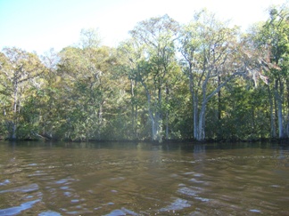
Cypress along the Waccamaw River
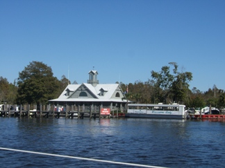
Marina along the Waccamaw River
Bundled up for cold weather along the Waccamaw River
Green can 81 at Shallot Inlet N.C.
Pontoon Bridge, Sunset Beach N.C.